The full review
The trailhead is ahead, the signal has vanished, and the café you counted on may already be closing. That is where I judge Google Maps: not by how many places it finds, but by whether it helps me reach the right entrance and plan the stops around a hike. I would use it for the drive and nearby essentials, with a separate trail map for the walk. The surprise is that business hours can matter more than the busiest-looking traffic line—and a quiet-looking place is not necessarily open.
Part 1 · 1 of 3Save the approach road, not just the trailhead pin
Before leaving reliable Wi-Fi, I open my profile picture, choose Offline maps, and select an area covering the drive, trailhead, and nearby town. A tight rectangle around the parking lot misses the point. I want the return route and an alternative food stop inside it too, especially where a valley road has only occasional reception.
Next I search for the actual trailhead rather than the mountain name. I inspect the place photos and use Street View on the approach where coverage exists, looking for gates, roadside parking, or a separate entrance. I save the chosen place to a custom list. That gives my trip planner a useful destination, rather than a pin somewhere beyond the accessible road.
Part 1 · 2 of 3The arrival time is only half the café decision
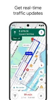
I like Maps most when the drive and the supporting stops sit together. Directions offers driving routes with traffic information while connected, so I can weigh arrival time against a café’s displayed opening hours. If the margin looks tight, I choose another stop before setting off. A route that gets me there quickly is not helpful if the kitchen has closed.
For a remote trailhead, I also inspect the final stretch rather than accepting the fastest route unquestioningly. A mapped road is not proof that access suits every vehicle or season. With a car rental, I would check the permitted roads and destination access separately. Maps handles the approach; entrance signs and current access information still decide whether I continue.
Part 1 · 3 of 3Busy times cannot tell you whether the gate is open
On place pages that offer Popular times, I treat the chart as a clue about a business, not a forecast for the whole hiking area. A café’s usual morning rush may help me choose when to collect food. It cannot establish whether the trailhead lot has spaces, whether a gate is unlocked, or whether a visitor centre is staffed.
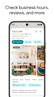
I check the hours section separately, including any displayed special hours, then look for recent photos or reviews that clarify the entrance. If my plan depends on one remote business being open, I contact it while I still have reception. My useful distinction is simple: hours describe availability; busy times suggest demand. Neither replaces checking the particular stop I need.
Driving to the walk? This is the useful half of the kit
I recommend Google Maps for hikers who need road directions, food stops, and a practical picture of the area around a trailhead. It also suits an airport arrival followed by a drive into patchy coverage: I can organize the approach before leaving the terminal. I would look elsewhere for detailed trail navigation, terrain assessment, or dependable backcountry positioning workflows. My dividing line is the parking area: Maps helps me reach it, but I want a purpose-built trail resource beyond it.
The listing, as we read it
- Developer
- Google LLC
- Version
- Varies with device
- Updated
- Nov 4, 2026
- Installs
- 10,000,000,000+
- Rating
- 3.4 out of 5
- Content rating
- Everyone
- Category
- Travel & Local
- Price
- Free
- In-app purchases
- No
- Ads
- Yes
Source: Google Play listing for com.google.android.apps.maps · read Nov 9, 2026
Google LLC publishes Google Maps, and Google Play marks it as free to install with ads. I read that as a reason to distinguish promoted places from the stop that actually fits my route, opening window, and parking needs.
The release notes describe bug fixes supporting place discovery and navigation. I take that as maintenance rather than a new hiking capability. My decision still rests on offline road coverage and careful place-page checks, not an assumed change to trail guidance.
What I check before the bars disappear
Part 2 · 1 of 4Offline maps need a freshness check
Inside Offline maps, I check that my saved area is current and review the automatic refresh options. I prefer doing that on Wi-Fi before departure rather than relying on a connection near the trailhead. Offline coverage is available only in supported areas, so I confirm that I can save the region while there is still time to arrange another resource.
I also give the saved boundary breathing room. A road closure might send me toward a different town, and a café with shortened hours might change my return stop. The area should cover those plausible alternatives. I do not expect offline Maps to preserve the full live place-search experience; I keep essential opening details and contact information separately accessible.
Part 2 · 2 of 4A saved map is not saved live traffic
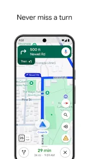
Offline maps can support driving navigation when the route lies within the saved area, but live traffic and alternative routes need connectivity. Walking, cycling, and public transport directions are not available offline. That is the limit most relevant to this trip: saving the countryside does not turn Google Maps into an offline hiking guide once I leave the vehicle.
Busy-time information has a similar practical boundary. I would not expect a live busyness indicator to keep refreshing after reception disappears, and many places have no chart at all. Even when connected, a quiet visitor centre tells me little about a separate parking area. I use these signals to adjust optional stops, never as reassurance about access or space.
Part 2 · 3 of 4Build the return stop before starting the outward drive
My list starts with the trailhead, then adds a food stop and an alternative with a later closing window. I check each place page while connected and note whether the displayed hours refer to the business I actually need. A visitor centre, its café, and nearby toilets can have different arrangements. One pin should not stand in for all three.
Before starting navigation, I compare the planned return with those opening windows and allow room for the walk to run long. I share the saved list if someone else is joining, but keep the essential details available separately. Sharing is useful for agreeing on a meeting point; it is not a promise that every place detail will remain accessible offline.
Part 2 · 4 of 4Use a trail map beside Maps, not instead of it
A dedicated trail map is my better choice for following paths and understanding terrain; Maps is my stronger starting point for finding nearby businesses and assessing the road approach. I would use both rather than make either carry the whole day. Official destination information is also worth checking for access restrictions that a business page or route suggestion may not resolve.
Compared with searching for each stop separately in a browser, Maps keeps place pages, saved destinations, and driving directions close together. That convenience is its real advantage here. The trade-off is that a tidy map can make uncertain information feel settled. I still separate three questions: where the entrance is, whether it is open, and how busy nearby businesses usually get.
My pick for the approach, not the trail
I value the connection between driving directions and place details more than any single map view. A correctly chosen entrance and a realistic food stop make this a useful companion before the walk begins.
My reservation is the boundary between saved geography and current information. I prepare offline coverage, check hours while connected, and treat busy times as context. With those habits, Maps earns its place without becoming my only navigation resource.
What I like
- I can save the road approach for patchy coverage.
- I can inspect entrances using photos and available Street View.
- I can compare opening windows alongside nearby stops.
- I can share a custom list of meeting points.
What I'd change
- I cannot use offline walking directions for the hike.
- I cannot infer parking availability from business busyness.
- I still need to verify essential opening and access details.
Google Maps FAQ
Can I navigate to a trailhead without signal?
I would save the surrounding area first. Offline driving navigation can work when the full route is within that area, but live traffic needs connectivity.
Will saving an area give me offline hiking directions?
No. I use a separate trail resource because Google Maps does not provide offline walking directions.
Can Popular times tell me when trailhead parking is quiet?
I would not make that leap. A chart for a nearby business describes that place, not the availability of spaces at a separate trailhead.
Should I trust the café hours shown on Maps?
I use them for planning, then contact the business if the stop is essential or the timing is tight. I also check any special hours displayed on its place page.
What should I save before leaving reception?
I save an offline area covering the approach and return alternatives, plus a list of the exact destinations. I keep essential opening details separately accessible and bring a suitable trail map.
 Best picksMy Location
 TipsCurrency converter offline
 CompareGps Map Navigation &
 How-toThe Official MTA App